The Society is published a short series of local walks to inspire those who were exercising within Government guidlines when the first COVID lock down came into being in March 2020.
There are maps attached so you can pick the point to start the walk which is closest to home. The mileages are very approximate and in practice you will walk a little further dodging the walkers, runners and cyclists. Happy walking!
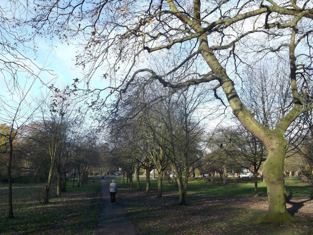
The walk starts at Wandsworth Common Station. From the ticket office lobby walk southwards with the railway on your left and the St James’ Triangle section of Wandsworth Common on your right. You will find that the way as far as Bedford Hill is signed as the Capital Ring.
Follow the path along the Common and into the alley way; at the end turn left into Balham Park Road. Continue along this road, crossing Boundaries Road, until you reach Balham High Road. Cross, turning right and then after a short distance turn left into Elmfield Road. Take the third right (opposite the Balham Leisure Centre) in to Cloudsdale Road. At the end turn left into the wide Ritherdon Road. At the top of the road turn right on to Bedford Hill (and ignore the Capital Ring signs in to Fontenoy Road).
When you reach the pedestrian crossing bear right on to Tooting Bec Common on a path marked at the start as Capital Ring. When you reach a clear cross-path, turn a very sharp right, almost back on yourself. After a short distance there is a path to your left down to the lake and the 145 million year old Fossilised tree. It is a legacy of the Victorian practise of placing geological curiosities on display as public attractions in urban parks.
Walk along the edge of lake until you see the tennis courts;
turn left across the grass and walk between the playground and the tennis courts.
Head over the field going to the left of the works depot. Cross Dr Johnson’s
Avenue and continue across the garss. Where you see a small path through the
shrubbery follow this. It takes you on duck boards around an empty but
attractively overgrown pond.
Where you join another path turn right and you will be taken
to light enabled crossing on Tooting Bec Road. Cross and turn right. Take the
first left into Avoca Road and first right into Topsham Road. Follow this until
you reach Upper Tooting Road. Turn left and cross this road at the lights;
almost straight across is Beechcroft Road.
After at least a mile you will reach Burntwood Lane. Turn
right and walk up beside the Sir Walter St Johns Sorts Ground. Cross Trinity
Road at the lights. Walk down Bellevue Parade and you are back to your starting
point.
There are various potential diversions on this walk including a wider circuit of Tooting Bec Common. For those curious about the redevelopment of Springfield Hospital turn left off Beechcroft Road into Glenburnie Road. Follow the road around and enter the Springfield campus. Work is progressing and the pavements are all in good condition. It is very accessible – with the site being a living hospital despite the contractors working on much of the area. Ignore the notices for motorists stating that the road is closed; the pavements are very much open. Just continue along the main spine road, past impressive buildings and the Share Garden on your right. At the end of the road turn right into Burntwood Lane and proceed to Beechcroft Road to join the circuit.
The starting point is
the mini roundabout at the intersection of Magdalen Road & Lyford Road.
Facing Wandswoth Prison turn left (westward and slightly downhill) on Magdalen
Road with the tennis club on your right. When you come to the wide gates of
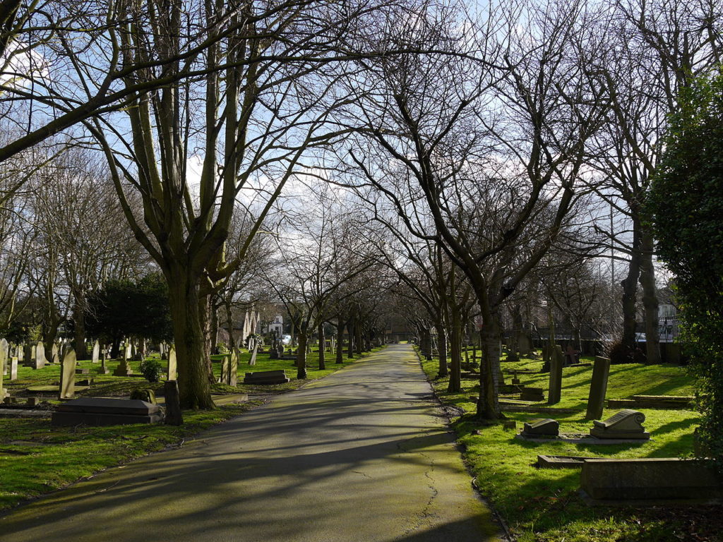
Wandsworth Cemetery turn in and choose a route along the grid of paths among
the graves.
The cemetery has been crammed into an irregular space between the road
and railway line and has (despite the trains) a peaceful air., partly due to
the to the mature trees throughout the site. As well as several thousand civil
graves there is a war cemetery with five 1914-1918 War Plots:
nearly 500 service men from all over the Commonwealth were buried here. This
was the closest burial ground to 3rd London General Hospital in the Royal
Victoria Patriotic building which housed thousands of wounded troops. In the
1914-1918 war. A further 115 were buried here in the1939-1945 war.
When you have finished wandering, exit the cemetery
through a pedestrian gate at the far end. Cross Magdalen Road into Tranmere
Road. Walk the length until you reach Waldron Road; turn right and then left
into Bridgford Street. At the end go straight across Burntwood Road and enter
Garratt Green playing field. Circumnavigate the field and exit where the fence
panel has been removed on the Aboyne Rad and mini roundabout.
Turn right up Burntwood Road and walk along beside the hedge; as you progress up the road you will see glimpses of the Springfield Hospital re-development site. When you reach the intersection with Beechcroft Road, cross Burntwood Lane and keep going for a short distance before turning left into Sandgate Lane; turn left.
Immediately into Sandgate Lane, bear right on to a woodland path into The Scope area of Wandsworth Common; take this until you reach a wide tarmac path with streetlamps; turn left and follow the path to the end on Lyford Road. Turn right and proceed along Lyford Road until you reach the starting point.
The walk starts
at Book House at the top of East Hill. Cross the road at the lights outside the
Co-op and turn left. Walk along the road and over the Trinity Road bridge and
its slip roads to reach the Common. Turn right over the grass and pass between
the two shrubberies on to a large expanse of grass called Northside Common;
try and spot the path across the middle, head for it and turn right so you are
heading south, parallel with Trinity Road. Follow
the path over the first cross paths to the second one (with another shrubbery
on your left). Bear left down the slope into the dip known as The Frying Pan,
the remains of an early gravel working.
On the far
side the path takes you up a slope to Windmill Road; cross this road and go
down John Archer Way, across the railway and past the Royal Victoria
Patriotic Building. At the end of this road there is a gate on to the playing
field. Turn left and walk round the edge including through the woodland above
the railway cutting. When you reach the tennis courts, skirt to the left of
them and enter the bowling green and flower garden. Your exit gate is directly
opposite; through this turn left by the Skylark Café. Bear left on the
path by the playground and walk to, and cross, the Cat’s Back bridge
over the railway.
On the
other side there is a choice of four paths; take the diagonal path to the left
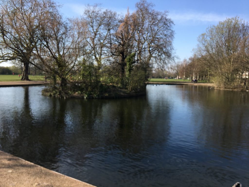
at 45 degrees to the railway. Go along this path and then cut across the grass
to Three Island Pond. Then go left along the path parallel to
Bolingbroke Grove until a tarmac path goes half left up to the playground. You
can then follow Chivalry Road until you reach Arundel Close. Go left and follow
the close round to the right; where the road runs out you will find a path
between the houses which eventually emerges on to Battersea Rise opposite the St
Marks Area of the Common.
Turn left
towards the traffic lights and left again in to Spencer Park. Walk along the
right hand pavement until you reach Northside Common again at a point
where Spencer Park takes a sharp right to become a minor residential road; walk up this road until you can cross the grass
to the central path; follow this up to North Side Wandsworth Common. Cross this
road, the South Circular, at the zebra crossing and turn left.
Before you
arrive back at the starting point of the walk you will see Mount Nod Huguenot
Burial Ground behind the railing on your right, soon to be added to the long
list of Wandsworth’s open spaces.
An interesting and varied riverside walk including a circular of Wandsworth Park
The walk starts at Wandsworth Town Station. From the station turn left into Old York Road under the railway bridge. After the bridge turn right into the gardens to admire the Bramford Community Garden along the bottom of the railway embankment. Exit the park into Swandon Way, going to the pedestrian light to cross over into Smugglers Way to the left of McDonalds. After the shop called Roche Bobois, as the road goes left, go straight ahead on the pedestrian route between the blocks of flats until you reach the river where you turn left into Nickols Walk.
At the end
of the flats the path goes ahead but ends abruptly so, before you get to the
end, turn left into Waterside Path. When you emerge back into Smugglers Way
turn right along the front of the Waste Transfer Station. Keep going to reach a
footbridge over the Wandle. Normally it is pleasant to walk on the Spit but
this is currently closed off (March 2020).
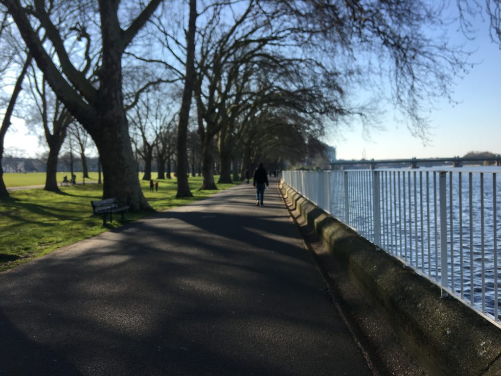
At the end
of the footbridge turn right on to the newly opened path around the Riverside
Quarter development, keeping going past the Thames Clipper pier and the
houseboats, into Wandsworth Park. Walk on the path right around the perimeter
until you are by the playground, back in the direction you came from.
Skirt around to the right of the tennis court and Putt in the Park until you reach a low exit gate on to Northfields; cross this road to the street named Point Pleasant and follow this round the corner until just before the Cat’s Back pub where you turn left into Eastfields. Just past the entrance to an underground garage, turn right between the blocks to Osiers Road where you turn left. After a short while turn left into Enterprise Way (by a Sainsbury’s Local) and walk to the end where you are in sight of the footbridge over the Wandle that you crossed earlier. Cross the bridge and before you proceed look for the Society’s plaque on the wall. Now turn right immediately before the second bridge into The Causeway which runs eventually along Bell Creek (note the bell on the left half-way along and massive workings of the Thames Tideway on the right).
At the end
of The Causeway by the Crane pub you meet the A3/South Circular on the
Wandsworth One Way system. Cross this road at the pedestrian lights (to your
right) and walk along Wandsworth Plain, past a row of Georgian houses. At the
end turn left for 100 yards along Wandsworth High Street before turning left to
enter the Ram Quarter. Meander through area this to reach the far exit into Ram
Street. Turn left and follow the pavement round to the right to cross Fairfield
Street into Old York Road – and back to your starting point.